Spanish settlement of Southern California began in 1697. The first presidio was established at San Diego in 1769. The first Spanish mission, San Diego de Alcalá, was built there that same year. In 1776, settlers founded a presidio and a mission where San Francisco now stands. Missionaries from the Roman Catholic Church greatly helped the settlement of California. By 1823, twenty-one missions had been established along a road called the El Camino Real. Each mission was built a one-day journey from the next.
In 1821, Mexico rebelled and gained independence of Spain. California then became a providence of the new Mexican government. Mexican governors were sent to California, but received much opposition from the Native Californians and returned to Mexico. Most of the mission lands were sold to private owners during this time. Many of these new landowners grew wealthy from their farms and ranches.
Jedediah Smith was the first American trapper to reach California in 1826. Other trappers followed and in 1841 the first organized group of American settlers came to California. During the years that followed, many pioneers made their way from the United States into California. These pioneers wanted California to join the U.S. and offered to buy the land, but Mexico refused to sell.
In 1844, U.S. Army explorer John C. Frémont led two surveying groups into California. Mexico ordered them out of their country, but they refused to leave. Other revolts took place, such as the Bear Flag Revolt led by frontiersman Ezekiel Merritt. The United States declared war on Mexico in May 1846. Mexico surrendered California in 1848 in the Treaty of Guadalupe Hidalgo; California then became a territory of the United States.
In 1848 just as the Mexican War was coming to an end, gold was discovered in the Sacramento Valley. News of the discovery brought thousands of prospectors from all over the United States. Many of them arrived in 1849, and thus became known as “Forty-niners.” Between 1848 and 1860, California’s population increased from about 26,000 to 380,000. Those who were not lucky finding gold stayed in California and became farmers and ranchers.
California became the 31st state on Sept. 9, 1850. By 1870, railroads connected California with the eastern U.S. and thousands of people continued to migrate west. Huge numbers of Chinese workers came to work on the railroads. During the 1880s, a depression in California led to unemployment and rioting in Los Angeles and San Francisco. Many thought the Chinese were to blame for the depression because they would work for little pay.
California’s population grew tremendously in the early 1900s. Irrigation allowed thousands of farmers to move into southern California. Oil and natural gas were discovered and mining became more important as other minerals than gold were found. By 1910, Hollywood had become the motion-picture capital of the world. Huge expositions were held in San Francisco (1914) and San Diego (1915) to celebrate the completion of the Panama Canal and show its importance to the state of California.
Many new industries were opened in California as the United States entered World War I in 1917. During the Great Depression (1929-1939), nearly 400,000 people moved to California in search of work. State leaders even passed laws to stop poor people from entering into California, but the Supreme Court declared this unconstitutional.
During World War II (1939-1945), California became a leader in producing airplanes, ships, and weapons. This provided employment for many without jobs, and helped the state’s economy. After Japan attacked Pearl Harbor in 1941, thousands of Japanese-Americans were taken from California to live in detention camps. In 1941, the United Nations Charter was approved in San Francisco.
After the war, many of those who had come to California to work for the military stayed. Others continued to come to the state in search of “the good life.” By 1963, California had the highest population in the country. This great increase in population created problems. State leaders struggled to provide more schools and better roads and public transportation. Smog became a serious problem in the larger cities. To help the growing need for water, the state began construction of canals, dams, and reservoirs. This program was designed to store and distribute water from northern California to the southern drier areas.
California has also been plagued with racial problems since the 1960s. In 1965, rioting broke out after a black man was unjustly arrested in Watts. Thirty-four people died in the riots and damages were estimated in the millions. Although state leaders strived to help minorities by increasing education, employment, and housing, almost 30 years later rioting occurred in Angeles due to police beating an African American. The beating was caught on video, but police officers were found not guilty of brutality.
As California’s education system expanded during the 1960s, college campuses became home to many student movements. The nation’s first major college demonstration occurred in 1964 at the University of California in Berkeley.
During the 1970s, California’s economy experienced a depression. This caused many to lose their jobs and created less revenue for needed education. However, by the 1980s the economy had improved. The aerospace industry increased as federal programs came to California. Santa Clara County became known as Silicon Valley for its production of high-tech electronic equipment.
Recently, California’s population has continued to grow steadily. The cities are very crowded. Large numbers of immigrants come from Asia, the Middle East, and especially Central America and Mexico. State leaders are striving to protect the growing number of minorities. Immigration, both legal and illegal, is now the most serious issue in California.
Wednesday, September 29, 2010
Monday, September 20, 2010
SACRAMENTO CALIFORNIA


Sacramento is the capital of the U.S. of California and the county seat of Sacramento County. With a 2010 estimated population of 486,189 it is the seventh largest city in California.
California State University, Sacramento, more commonly known as Sacramento State or Sac State, is the major local university. It is one of the twenty-three campuses of the California State University system.
Geography
According to the United States Census Bureau, the city has a total area of 99.2 square miles, 97.2 sq mi of which is land and 2.1 sq mi water.
Climate
Sacramento has a Mediterranean climate that is characterized by cool, wet winters and hot, dry summers. The "wet season" is generally October through April, though precipitation does occasionally fall as late as June or as early as September. Winters are usually rainy, cool, and foggy. Spring is rainy early then gradually becoming dryer and warmer. Summers are hot, dry and sunny. Autumn is usually warm early then cool and rainy.
Wednesday, September 8, 2010
HISTORY OF CALIFORNIA
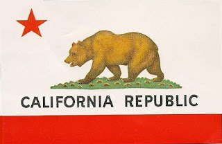
The Name "California"
CALIFORNIA HISTORY TIMELINE
| |
|
Wednesday, September 1, 2010


Cabrillo National Monument
Great views of San Diego Bay, wildflower-covered hillsides, whale watching, an historic lighthouse and tidepools along a rocky coastline are the attractions of Cabrillo National Monument, which covers a small area of less than one square mile near the southern end of Point Loma, a narrow spur of land jutting out into the Pacific Ocean. The monument is little known compared to the large national parks of California but its city location ensures a steady stream of visitors all year.


Point Reyes National Seashore
Around 150 miles of trails cross-cross the rolling hills and meadows of Point Reyes though the main attraction is the 60 mile shoreline, which is easily accessible by car in several places and all is explorable on foot. There are three distinct parts of the coast - the section alongside the calm waters of Tomales Bay has a few small beaches though the majority of the land is quite densely wooded, the trees extending right to the edge of the sea. The long, straight, northwest-facing shore (Point Reyes Beach) has the most sand and the highest surf, though also suffers from the worst weather, with strong winds, cool temperatures and thick fog often present. More interesting is the southwest coast, as here the land is a little less wind-swept and the shoreline varies between sandy beaches, rocky terraces, promontories, cliffs, lagoons and dunes.


Muir Woods National Monument
There are many places in north California with more impressive redwood trees, but Muir Woods is very popular (receiving nearly one million visitors each year) on account of its proximity to San Francisco, just 15 miles south via the Golden Gate Bridge. Named after the famous Scottish naturalist, conservationist and explorer John Muir, who visited here several times from 1903 onwards, the woods form a small part of the forested slopes of Mt Tamalpais, near the southern end of the Marin Peninsula. The east edge of this region is quite developed, along busy US 101 (the Redwood Highway) through such towns as Sausalito, Corte Madera and San Rafael.


Lava Beds National Monument
The national monument has large areas of jumbled lava flows, last deposited as recently as 2,000 years ago, mixed with a variety of volcanic features including cinder buttes, spatter cones, chimneys, craters and especially lava tube caves, of which over 400 have been discovered so far. The surrounding countryside also has craters and extensive patches of lava, continuing east to the Cascades and south towards Lassen Volcanic National Park, all associated with the same tectonic system.


Kings Canyon National Park
Kings Canyon National Park preserves a huge unspoilt and beautiful area of the central Sierra Nevada mountains, containing several deep glaciated canyons, countless lakes, pools, meadows and waterfalls, and over 20 peaks that exceed 13,000 feet. The park also shelters six groves of giant sequoia trees, found near the southern boundary which is shared with Sequia National Park: the two are administered as one unit, and have similar scenery except that Sequoia has more of the huge trees.


Joshua Tree National Park
Joshua Tree National Park is popular with the more thoughtful traveler, since there is no spectacular central attraction as is the case with many other Southwest parks, just many square miles of wild, unspoilt desert scenery. Two factors make the park special; the eerie, spiky Joshua trees which grow densely in the western half, and the extensive outcrops of huge granite boulders, up to 100 feet high, which line the mountain ranges scattered over the whole area.


NATURAL PLACES TO VISIT IN CALIFORNIA


Devils Postpile National Monument
Devils Postpile National Monument occupies a rectangle of land just 2.5 by 0.5 miles in extent, alongside the North Fork of the San Joaquin River in the central Sierra Nevada mountains. The river forms a powerful cascade (Rainbow Falls), and the surroundings are a typically beautiful Sierra combination of granite, forest and hills, but the main attraction is an outcrop of volcanic basalt composed of parallel, multi-sided columns, a relic of long ago eruptions from a nearby volcano.
Subscribe to:
Comments (Atom)